The territory is located just north of the confluence of the Niger River and Benue River. It is bordered by the states of Niger to the West and North, Kaduna to the northeast, Nasarawa to the east and south and Kogi to the southwest.
Lying between latitude 8.25 and 9.20 north of the equator and longitude 6.45 and 7.39 east of Greenwich Meridian, Abuja is geographically located in the centre of the country.
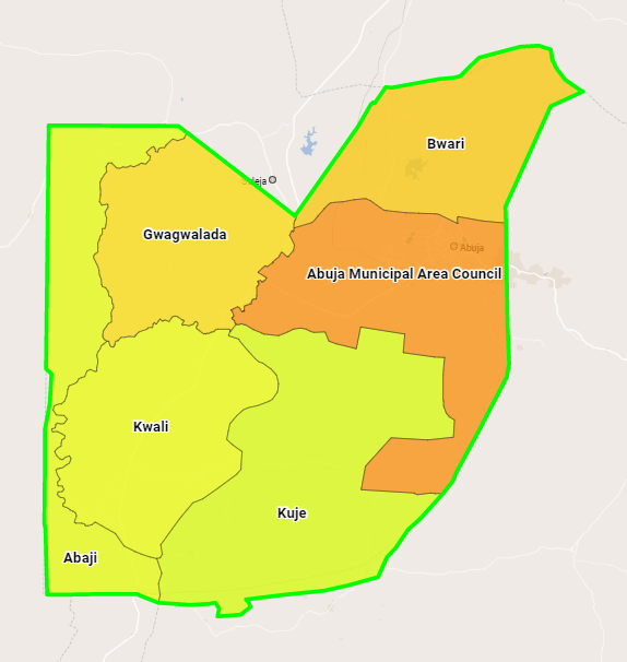
The Federal Capital Territory has a landmass of approximately 7,315 km2, and it is situated within the savannah region with moderate climatic conditions.
Unlike the States of Nigeria, which are headed by elected Governors, it is administered by the Federal Capital Territory Administration, headed by a minister appointed by the President.
The Federal Capital Territory, also known as FCT was created upon the promulgation of decree number 6 of 1976. It came into existence due to a need to find a replacement for the capital city of Lagos which had become congested and had little space for expansion. The area chosen as the new capital was principally Gwariland with high concentrations of Muslims and Christians and a high degree of neutrality from the dominant ethnic groups. It is the least populated State in Nigeria.
Decree 6 of 1976, gave the federal government rights over land within the territory. The population density prior to the takeover by the government was sparse with a population of 120,000 residents living in 840 villages and mostly of Gwari heritage. Inhabitants were relocated to nearby towns like Suleja in Niger state and New Karshi in Nasarawa State on the outskirts of the territory.